The Sacred Map
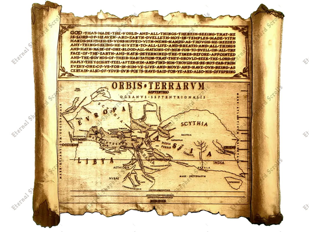
In the year 30 A.D., a Man in Galilee began the journey that would divide history itself. This map presents the known world exactly as it stood in that year, reconstructed from the ground up — not copied from any surviving document, since none survived, but rebuilt letter by letter and coastline by coastline to reflect the geography, the language, and the very writing conventions of that specific moment in time.
To hold this map is to hold more than geography. It is to look upon the very world Christ stepped into — the same letters, the same tongues, the same roads and seas — the world as it stood in the moment before Jesus Christ, the Son of God, changed it forever.
Consider, first, the smallest things — for even a single letter can carry an age within it. There is no letter "U" to be found upon this map — for in that age, none existed. The Latin tongue of the first century carried but one letter to do the work of two, so that a scribe of Christ's own lifetime would have carved "SERVUS" as "SERVS," and the U we take for granted today would not stand on its own for a thousand years and more. So too the small dots set between each word: not ornament, but the interpunct — the very mark by which the Romans of that hour divided their words, a custom already fading toward silence within two centuries of the Cross. A hundred years earlier, and it would not yet exist. A hundred years later, and it would already be forgotten. It belongs to this moment, and to no other.
The map bears its title in the Roman tongue — Orbis Terrarum, "the circle of the lands" — and orders the world as the ancients themselves beheld it: Europa, Asia, and Libya, gathered round the Mare Internum, the "inner sea" now called the Mediterranean. No line of latitude or longitude bound their world as it binds ours. They measured instead by circuli — the equinoctial and solstitial circles, drawn by the turning of the seasons and the lengthening of days — and by distance counted not in miles, but in stadia, reckoned outward from cities whose names still echo: Byzantium, Alexandria, Rhodes. And at its foot are set the very figures the geographer Strabo himself once recorded for the breadth of the inhabited earth — seventy thousand stadia in length, thirty thousand in width — his own reckoning, carried now onto wood nearly two thousand years hence.
This map is not a copy of anything, for nothing of that year remained to copy. It is a window, built plank by plank, back into it — offered not as curiosity, but as companion for the soul: a witness in wood that the Gospel entered a real world, at a real time, among real nations, "that they should seek the Lord, if haply they might feel after Him, and find Him" (Acts 17:27).
 1 / 9
1 / 9
☩ A singular artifact of original historical research ☩
☩ Carved with Care and Love ☩